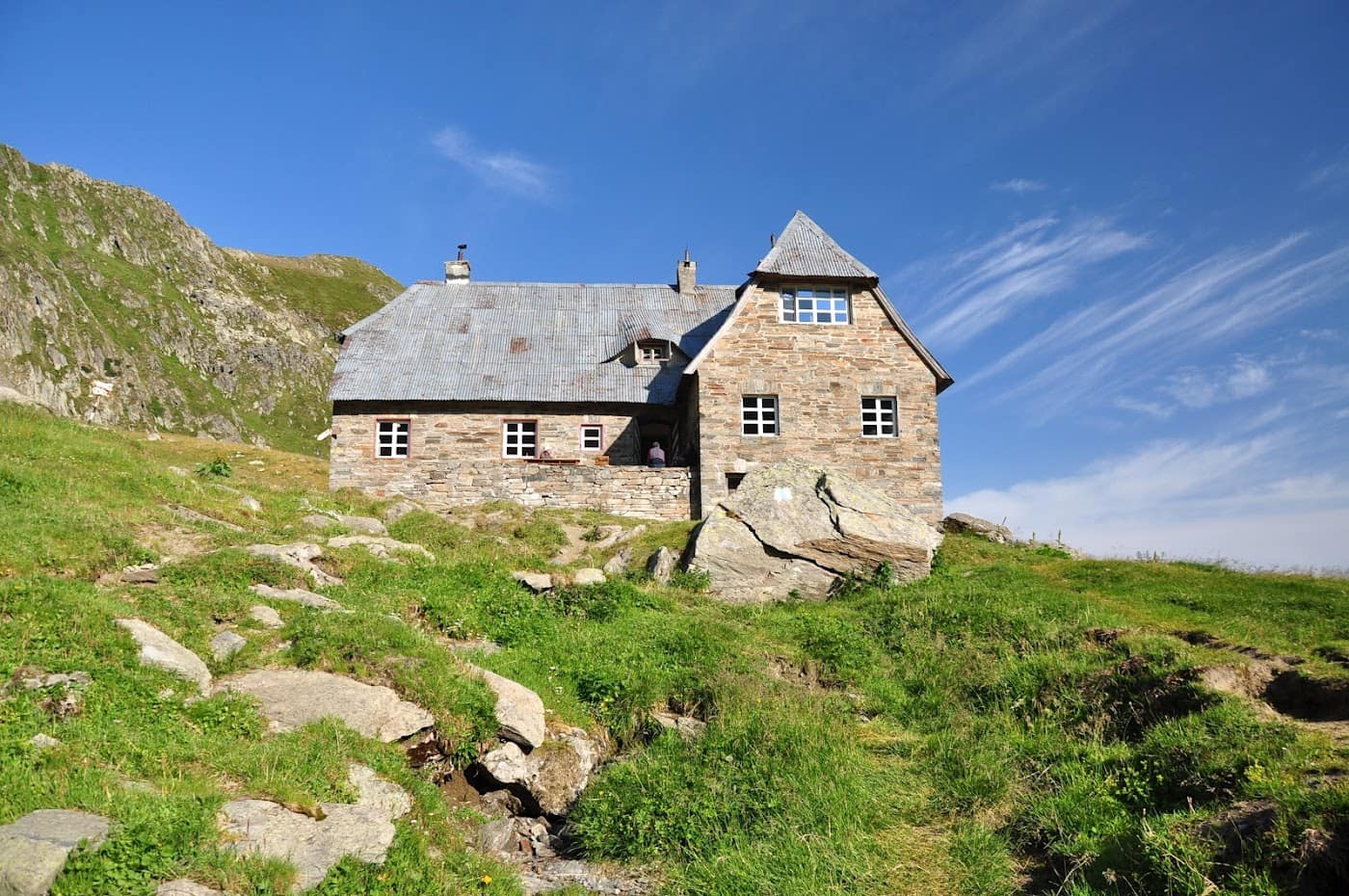
Cabana Podragu is one of the most important chalets in the Făgăraș Mountains, set beside the Podragu glacial lake at roughly 2136 m, in the Făgăraș – Transfăgărășan area. It is the main launch base for Moldoveanu Peak, Romania's highest summit, and a key junction on the Făgăraș ridge.
Located in an impressive glacial cirque, the chalet shelters hikers crossing the great Făgăraș traverse or aiming for the surrounding peaks. The alpine scenery, the lakes and the cliffs make Podragu a memorable place.
Getting there
- From Valea Sâmbetei / Victoria – Arpaș, on marked paths climbing toward the Podragu cirque (red stripe / triangle marking), a climb of about 4–6 hours depending on the starting point.
- From the main ridge, via the Podragu saddle, for those walking the Făgăraș ridge.
What to do from here
- Tackle Moldoveanu Peak (2544 m) on the Cabana Podragu – Moldoveanu trail.
- Climb onto the main ridge and continue the great Făgăraș traverse.
- Explore the nearby glacial lakes and cirques on marked paths.
Tips
- The safe season is July–September; outside it, snow and ice may linger on the trails.
- Sleeping capacity is limited and in high demand during the season — check availability in advance.
- Weather on the ridge changes rapidly; check the weather and save the Mountain Rescue number.
⚠ Indicative data — needs verification
Experiences & tours
Tours & activities · Munții Făgăraș & Transfăgărășan
Excursions, guided tours, adventure and tickets — book online, many with free cancellation.
Stays in the area
Stays nearby
Compare stays available near this place, on the map.
Accommodation map by Stay22 · indicative prices. Bookings through the map may earn a commission, at no extra cost to you.
Frequently asked questions about Cabana Podragu
When is the best time to visit Cabana Podragu?
For peaks, lakes and alpine roads, the ideal window is summer to early autumn (June–October), when the weather is more stable and access is easier. Check the forecast first, as conditions change fast at altitude.
How do you get to Cabana Podragu?
The easiest way is by car to the area, then on the marked trails or access roads. See the map below and plan your route by season and road conditions.