Trail
Lacul Bucura – Vârful Peleaga
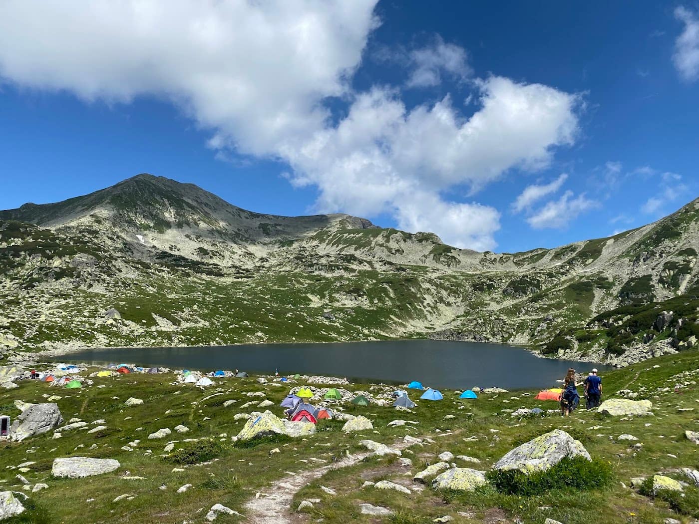
The climb from Lake Bucura (2040 m) to Peleaga Peak (2509 m) is the natural route to the highest summit of the Retezat, starting right from the massif's finest glacial cirque. It is a moderate tour, short in distance but with a boulder-field finish that demands care. You set off from Lake Bucura, the largest glacial lake in Romania.
Figures are indicative: reckon ~2 hours of climbing, ~5 km and +~470 m of gain, depending on pace and weather. Take your water from the Bucura area before starting; up on the ridge and the boulders there are no reliable sources. Treat the numbers as references.
On the trail
You start at Lake Bucura on the red triangle, then pick up the blue stripe to the summit. Check the exact marking locally, especially in fog.
- Start (Lake Bucura, 2040 m). From the campsite you climb the marked path eastward along the lakeshore, on grassy terrain with flat stones.
- Toward the saddle below Peleaga. The path climbs steadily to the ridge between Peleaga and Bucura, opening onto the cirque of lakes.
- The final boulder field. The last segment crosses large boulders where your hands help with balance; this is where most time is lost and where minor injuries occur.
- Peleaga Peak (2509 m). The highest point of the Retezat, with a full panorama over the lakes, Custura and Păpușa. See Peleaga Peak.
The descent usually follows the same route back to Bucura; you can combine it with a trip to Lake Zănoaga. Time it so you are down in daylight.
Equipment and difficulty
Moderate difficulty, raised by the final boulder field and the altitude.
- Boots with a stiff sole and good grip on rock.
- Water for the whole tour (1.5–2 l), taken from the Bucura area.
- Insulation + hardshell — weather changes fast on the ridge.
- Headlamp, map/GPS, basic first aid.
- Sure footing on slabs and scree.
See the Retezat guide and Retezat National Park.
Safety
A short route, but on real alpine terrain where weather and the boulders are the main risks.
- Unstable boulders — rocks shift; step carefully and avoid sending stones onto people below you.
- Weather and lightning — afternoon storms are common in summer; start early and descend in good time. Check the weather.
- Fog — on the ridge, poor visibility easily leads to disorientation; follow the marking.
- Residual snow — early in the season, hard snow tongues can linger on the slope.
When to turn back: if the weather breaks or the boulders are wet and slick, return to Bucura. You are in a protected area — respect the park rules. Read the mountain safety and weather guide.
Emergencies: 112 (Salvamont).
⚠ Indicative trail data. Mountain weather changes fast — check the forecast, markings and conditions before you set off. Tell someone your route.
Trail map
Indicative topographic map (OpenTopoMap) — it shows the terrain and the marked paths. Download the route offline and don't rely on signal on the ridge.
Plan your trip
Everything you need for the mountains
Affiliate content: bookings through these offers may earn us a commission, at no extra cost to you.
Stays in the area
Stays nearby
Compare stays available near this place, on the map.
Accommodation map by Stay22 · indicative prices. Bookings through the map may earn a commission, at no extra cost to you.
Frequently asked questions about the Lacul Bucura – Vârful Peleaga trail
How long does the Lacul Bucura – Vârful Peleaga trail take?
The stated duration is indicative and depends on your pace, breaks and the weather. Start early and leave enough time to return before dark.
What gear do I need?
Grippy boots, clothing layers, a rain shell, water, food, an offline map/app and a head torch. At altitude, pack a warm layer even in summer.
Is the Lacul Bucura – Vârful Peleaga trail safe?
With preparation and good weather, yes. Check the forecast, tell someone your route, turn back if the weather worsens and save the emergency number 112 (mountain rescue). Ridge routes require experience.