Trail
Peștera – Vârful Omu
The route from Cabana Peștera to Omu Peak (2514 m) takes you to the highest point in the Bucegi, crossing the alpine plateau to the northern ridge. It's a hard hike because of its length, altitude and exposure to wind and weather — suited to those in good shape with experience of a full-day tour on the plateau.
The figures are approximate: roughly 4 hours, ~9 km and +~800 m of gain. Real time depends on your pace, your load and the weather — in fog or strong wind, plan for more.
On the trail
You set off from Cabana Peștera (~1610 m), in the area of Ialomița Cave, following the red cross marking.
- Start (Cabana Peștera). Climb from the cabana on a path, gradually leaving the wooded zone for the alpine open.
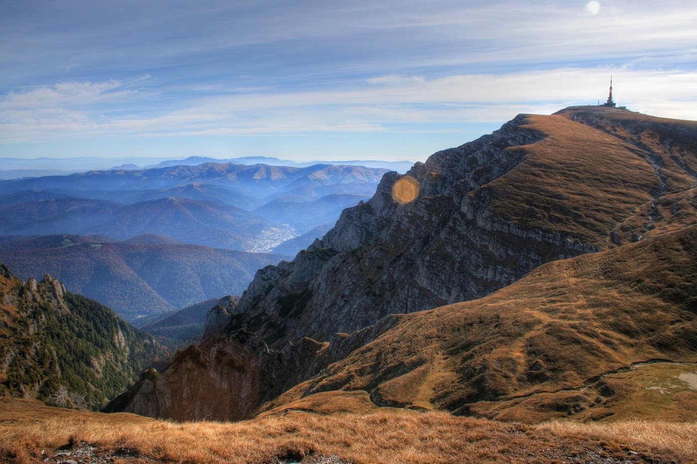
- Onto the plateau. After the steeper opening, you reach the Bucegi plateau, with open scenery and alpine meadows. The red-cross marking leads you steadily north.
- Crossing the plateau. A long, rolling section beneath peaks and saddles. Wind is almost always present, and in bad weather the landmarks vanish quickly. Don't rely on reliable water sources — carry your own.
- Approaching Omu. The gradient builds again toward the final ridge, the ground turning rocky and exposed.
- Omu Peak (2514 m). The highest point of the massif, with the Omu refuge / cabana and a broad panorama over the Bucegi, Valea Cerbului and, in good weather, the surrounding mountains.
From Omu you can link onward to Omu Peak — attraction, to Babele (see Babele – Omu) or descend toward the Prahova Valley. All within Bucegi Natural Park.
Gear and difficulty
Difficulty is hard because of length and altitude, not technical passages — but exposure to the weather is high.
- Good boots and a thermal layer are mandatory; Omu can be cold and windy even in summer.
- Rain shell / hardshell — the weather changes abruptly above 2400 m.
- At least 2 l of water, snacks, headlamp.
- Map / GPS and compass — navigation on the plateau is critical in fog.
See the gear guide and the Bucegi hiking guide.
Safety
The Bucegi plateau looks gentle, but it's dangerous in bad weather — exposed, with no natural shelter over long stretches.
- Fog is the main hazard: on the open plateau you can lose your bearings within minutes. Follow the markings and carry navigation tools.
- Lightning — in a storm the high plateau is very exposed; get off the open ground.
- Wind and cold — temperature drops sharply with altitude and wind.
Retreat option: if the weather turns on the plateau, head back to Cabana Peștera on the same marking or take shelter at the Omu refuge. Don't push blindly into dense fog. Check the weather and the safety guide before you set out.
Emergencies: 112 (Salvamont mountain rescue).
⚠ Indicative trail data. Mountain weather changes fast — check the forecast, markings and conditions before you set off. Tell someone your route.
Trail map
Indicative topographic map (OpenTopoMap) — it shows the terrain and the marked paths. Download the route offline and don't rely on signal on the ridge.
Plan your trip
Everything you need for the mountains
Affiliate content: bookings through these offers may earn us a commission, at no extra cost to you.
Stays in the area
Stays nearby
Compare stays available near this place, on the map.
Accommodation map by Stay22 · indicative prices. Bookings through the map may earn a commission, at no extra cost to you.
Frequently asked questions about the Peștera – Vârful Omu trail
How long does the Peștera – Vârful Omu trail take?
The stated duration is indicative and depends on your pace, breaks and the weather. Start early and leave enough time to return before dark.
What gear do I need?
Grippy boots, clothing layers, a rain shell, water, food, an offline map/app and a head torch. At altitude, pack a warm layer even in summer.
Is the Peștera – Vârful Omu trail safe?
With preparation and good weather, yes. Check the forecast, tell someone your route, turn back if the weather worsens and save the emergency number 112 (mountain rescue). Ridge routes require experience.